
You are using an out of date browser. It may not display this or other websites correctly.
You should upgrade or use an alternative browser.
You should upgrade or use an alternative browser.

Trails Off Road / OnX
- Thread starter inkedrose
- Start date
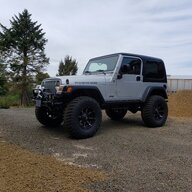

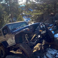
I ended up getting OnX during memorial day sale. I Still keep going back to COTREX when I'm on trail and for charting. It's more user friendly... and what I know. OnX is nice that it has a trail rating and first hand reviews but it's been wrong several times about closures. This time of year gates are opening fast due to weather, that was something I was hoping it would be accurate about. Had a trail that was open and I'd been running for a couple weeks. Several people reporting it closed. Guessing they were at the wrong trail head. Kept the traffic down which was nice

no on-trail experience so far, but my thoughts on planning. For context, I'm doing my annual trip to SW CO which is mostly for scenic purposes, and we end up camping in 3 different places in 3 nights, but a patchwork of jurisdictions and private mining claims requires advanced planning to avoid ending up hours from a campsite when it's time to call it a day. Most of the trails are on the easier end but most of the group is driving less capable vehicles so I need to be mindful of not getting anybody in over their heads, but also not bore us all to death with hours of dusty washboard freeways.
TL;DR:
TrailsOffroad is a fantastic resource for understanding everything a trail consists of, with waypoint-by-waypoint descriptions of primitive campsites, obstacles, scenery, etc as well as detailed info on management agency, expected time to complete, tips for enjoying your trip, seasonal open/close dates, etc., but it's not that great for mapping/route planning multiple trails at a time. It'll let you follow a trail that you're on, and it does offer file exports for you to import into actual mapping softwares.
COTREX is a mapping and route planning resource that shows every possible road you can take in an area based on the type of vehicle you're using (or not using), and all the "official" data for it, but lacks descriptions or any detailed data on difficulty, scenic value, etc. It's a Colorado state project, so only works in Colorado. It's like a USFS Motor Vehicle Use Map updated for 2023 and including state and other federal management agencies than the Forest Service.
OnX Offroad is like a combination of the two, but it doesn't do either job quite as well. It lacks the detailed official data that you can find on COTREX or a USFS MVUM, and it doesn't detail obstacles, campsites, etc as thoroughly or as consistently as TrailsOffroad.
The details:
Since none of the options really do everything, I'm putting my laptops cooling fan to full use by using ALL of them. I have separate browser tabs open running OnX, TrailsOffroad, COTREX, and then I have Avenza Maps with MVUM's on my phone. All to plan ~3 full days of "overlanding".
1. Start with OnX or COTREX to see all possible roads/trails.
2. Check TrailsOffroad to find technical and scenic values, camping opportunities, etc. Go back to OnX or COTREX to save tracks and interesting waypoints.
3. If not on TrailsOffroad, COTREX will tell me if it's BLM or what USFS Ranger district it's in, and if it's USFS I can check camping legality on MVUM. OnX won't.
4. Go back to OnX or COTREX and zoom in on aerial view to find and mark possible campsites.
5. Use OnX or COTREX to piece together a days worth of trails, waypoints, and that nights campsite.
6. share with the rest of the group (who don't need a paid subscription for COTREX but would for OnX)
All in all, since I'm planning the trip in Colorado, OnX could be completely substituted here by COTREX and I wouldn't miss anything that was worth the subscription fee. Outside Colorado though, there is no COTREX and I would need OnX to do what I'm doing, and either way would still also need TrailsOffroad.
Point for OnX (maybe?): I have spotted a couple of instances where TrailsOffroad specifically marked previously used campsites with improvised stone fire rings as possible campsites, but appear to be on private land when I go to mark them on OnX. COTREX has no indication either way but the MVUM seems to agree with OnX.
View attachment 436124
Point for TrailsOffroad: I also found an instance where OnX and COTREX both show a road continuing but TrailsOffroad describes a major washout with a photo that shows it clearly impassable by most vehicles. (red waypoints on OnX are mine, the washout is waypoint 3 on the TO screenshot)
View attachment 436119
View attachment 436121
View attachment 436122
OnX
Pros
I like the interface, the hybrid aerial/topo view. I like the process of creating and saving routes and wavepoints. I like that it's obvious whether land is public or not by showing the top level management agency such as BLM, the name of the national forest, etc. It does mark more points of interest than COTREX, so the names of mountains, mines, etc in the area are right there on the map.
View attachment 436116
View attachment 436117
View attachment 436118
Cons
I don't like that it seems curated by the public, so there's not consistency in what data is available from one road to the next, and having been burned by resources that do things this way in the past (such as AllTrails, what garbage) it makes it hard to take things at face value and I want to verify everything with other sources, which brings my attention to the fact that the roads are labeled only by their colloquial names, so I can't get a USFS or county road for it. I don't like that it doesn't give me the management agency down to the local (Ranger District) level. Has no data on whether dispersed camping is allowed on a given trail. Has some descriptions and photos which COTREX lacks, but nothing close to TrailsOffroad.
Trailsoffroad
Pros
staff-curated, so there's consistency in the descriptions, data, and technical ratings with and without taking bypasses. Plenty of photos so you know what you're getting from both scenery and technicality. It tells you the management district, the official name/number of the road, current status, estimated time to complete, and even suggests a best direction for through-trails. Every trail description tells you whether there's camping available and where. It's probably the single best resource in existence for planning a trip from far away when details matter.
View attachment 436109
View attachment 436110
View attachment 436111
View attachment 436112
View attachment 436113
Cons
No apparent means of creating custom routes, waypoints, etc.
COTREX
Pros
Similar route/waypoint planning capability as OnX, but government curated so it feels fairly trustworthy not to lead me onto a road that isn't legal. It combines all management agencies so pretty much everything is there including National Forest, county roads, etc and it tells me the management agency down to the ranger district.
View attachment 436114
Cons
Limited data on what to expect from any particular trail. Very little technical difficulty info, no scenery info. Improved campsites are marked but no info on availability of primitive/dispersed camping. Can't create a new route in the web browser version, have to create it on the mobile app and then I can go back to the PC browser to add to and edit it.
View attachment 436108
something I just realized with Cotrex is I can't add custom waypoints. I can do that on OnX, but with COTREX I'm limited to destinations that already exist in the database, which means I can't pin specific locations for photo ops or to check out what looks like a usable primitive campsite on aerial view. It will let me add a "field note" but it will only let me add it for my current GPS location, which does me no good from 800 miles away.

Thread revival… but this seemed the best place to ask this. Who has seen the premium vs elite mapping differences using ONX?. I am interpreting that you can get more recent satellite imagery in the premium???
Can I run this on my IPad and my phone? Or does that require two separate purchases?
The sale price of $17.50 pretty tempting to try.
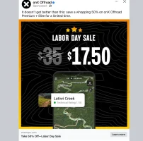
Can I run this on my IPad and my phone? Or does that require two separate purchases?
The sale price of $17.50 pretty tempting to try.
Of course they have that deal 3 weeks after I renewed.
I used onx as my main route planning and navigation app this year. I find it works pretty well for that when I already know the area.
As I talked about in my long post last year, the trail info and technical difficulty ratings are not good. I found multiple instances where a trail would be a 4 in Trailsoffroad and a 7 in onx, or the opposite, which could really cause some problems leading a group that includes a couple of near stock Tacomas and novice wheelers.
There are also a lot of trails that aren't named correctly, multiple trails in one object under one name, don't follow the correct route according to MVUM, etc.
I DO really like that I can just click in open space and it tells me whether it's NF, BLM, wilderness, etc. That helps tremendously in finding camp sites and making sure I'm not gonna have a deputy hassle us about setting up on a private mining claim. I've even found a couple campsites marked as legal in Trailsoffroad that are on private property.
I used onx as my main route planning and navigation app this year. I find it works pretty well for that when I already know the area.
As I talked about in my long post last year, the trail info and technical difficulty ratings are not good. I found multiple instances where a trail would be a 4 in Trailsoffroad and a 7 in onx, or the opposite, which could really cause some problems leading a group that includes a couple of near stock Tacomas and novice wheelers.
There are also a lot of trails that aren't named correctly, multiple trails in one object under one name, don't follow the correct route according to MVUM, etc.
I DO really like that I can just click in open space and it tells me whether it's NF, BLM, wilderness, etc. That helps tremendously in finding camp sites and making sure I'm not gonna have a deputy hassle us about setting up on a private mining claim. I've even found a couple campsites marked as legal in Trailsoffroad that are on private property.

I subscribe to Trails Offroad and Gaia. Never tried Onx though. I've wheeled with the owner of Trails Offroad (Joshua) a few times. Though the page lists someone else as the founder? I read that they are going to at some point include TO on Wranglers. So don't know if that has happened yet.
As someone who is directionally challenged, I often use it to get to the trail head. I've never gotten lost while using it, and that is saying a lot lol. I'm that guy that pulls up google maps the first 20 times I'm going somewhere. Without apps like this, I would've hosted less trail runs. With it, I can pretend I know where I'm going.
As someone who is directionally challenged, I often use it to get to the trail head. I've never gotten lost while using it, and that is saying a lot lol. I'm that guy that pulls up google maps the first 20 times I'm going somewhere. Without apps like this, I would've hosted less trail runs. With it, I can pretend I know where I'm going.

I subscribe to Trails Offroad and Gaia. Never tried Onx though. I've wheeled with the owner of Trails Offroad (Joshua) a few times. Though the page lists someone else as the founder? I read that they are going to at some point include TO on Wranglers. So don't know if that has happened yet.
As someone who is directionally challenged, I often use it to get to the trail head. I've never gotten lost while using it, and that is saying a lot lol. I'm that guy that pulls up google maps the first 20 times I'm going somewhere. Without apps like this, I would've hosted less trail runs. With it, I can pretend I know where I'm going.
I subscribed to TO this year as well, they got me with a half off promotion.
My use case so far was finding and planning a run of a new trail I'd never done with a difficulty rating that was neither too easy or difficult for my group. I like that you can just pull up the map for an area and easily see trails in the area, the color coding of the trails also makes it easier to select a trail that has the difficulty I'm looking for.
The follow mode is also helpful when you're on the trail to have an idea of where you're at, how far still to go, and upcoming obstacles and waypoints.
When my subscription runs out to TO, I'm thinking about trying OnX for a year to compare and decide if there's one I want to commit to.
I had OnX for a year and wasn't a fan. Stuff was listed as closed that I knew was open, reports weren't great. I got TO for this season, I like it a little better. Still find myself using CoTrex more than anything which is a free ap

OnX is offering a 50% deal for Labor Day.
Promocode: LABORDAY50
Promocode: LABORDAY50

I use OnX (both hunt and off-road) and like how easy it is to navigate. I use both while working as I spend a lot of time on primitive trails and road systems. OnX can be spendy but it does what you expect it to. Recent imagery is nice on off-road elite.
For CO I use Trails Offroad.
Though recently I bought OnX and it has been pretty handy. You can set way points, look at latest aerials, works offline, but it does come with the expensive pricetag and needs annual renewal.
Though recently I bought OnX and it has been pretty handy. You can set way points, look at latest aerials, works offline, but it does come with the expensive pricetag and needs annual renewal.
Another thing to note about Trails Off-road is that all Jeep Badge of Honor trails are free on there. So if you use OnX (like me) you can also view all of the waypoints and obstacles on Trails for those certain trails.
I bought both, Trails offroad is the one I like best. Bought on a holiday special and have renewed it. For here in Colorado, CoTrex is still my favorite. Only problem with Cotrex is theres no difficulty ratings or reviews but accuracy and ease of use makes it my go to. In Combination with Trails Off Road it works good for me
Similar threads


- Replies
- 29
- Views
- 6,567


- Replies
- 6
- Views
- 1,257


- Replies
- 18
- Views
- 4,908

