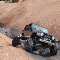
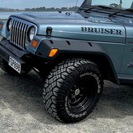
What's even better is the control you get on the trail. You have a bunch less pedal pressure to get the same performance. Comes in handy when your sitting at a steep incline/decline waiting for the guy in front of you to get past an obstacle and you have to keep your foot on the brakes for longer than you like.
That's a nice demo video.
 
I really enjoyed Hole in the Rock and would recommend it for TJFest if it weren't so far away.
It is truly fun. I would say the best trail I've been on. Recently given a badge of Horror (err honor) trail. The incredibly modern airstrip (jet capable) will sell gas rather than going down to the Rec area. Here's some advice and info....
Plan to be out 5 nights minimum. 1st and 5th night are at the beginning of trail. 2nd, 3rd, & 4th night should be off of and west of Gray Mesa. One day for the Rincon and one day for the Chute and Cottonwood Canyon. If you're an animal, hike to Register Rock and back. Top up at airstrip if you can. Carry another 7 gallons of gas. 10 is better. Rip out the stupid console and put a small fridge there. Be sure you can still operate the Ebrake.

1) 7500 foot Airstrip. Could be longer. 1A) Recommended entry and exit
2) Old entry to Lake Canyon now closed due to massive flood around 2006. I got to do this back in 2004 in my XJ! The new route swings around south to meet up with the eventual ascent to Gray Mesa. Can backtrack to Lake Canyon if you want...take another day.
3) Gray Mesa and San Juan River Overlook. Cell tower is on top of Navajo Mountain to the south.. great coverage.
4) To the left of the number you can make out the impressions of the Chute. It's not nearly as bad as Hell's Gate on Hell's Revenge.
5) End of trail at beginning of Cottonwood Canyon. you can see Lake Powell 3 miles down canyon.
6) The Rincon, now open. Have not done that...Who wants to meet me for a trip?
7) Hole in the Rock on west side; Register Rock on east side.
1-Overview.jpg

Detail of second finger of Lake Canyon crossing...I'm so lucky I got to do that.
1) Note the carve out in the rock cliff. That's the road and the very same trail the Mormons cut out of the rock.
2) The other side of the canyon.
2-Detail of LakeCanyon(Closed).jpg

North end of Gray Mesa. Note the road appears to be a scratch.
3-climb to Gray Mesa.jpg

Below is a detail of above circled terrain and the approximately 1000 ft ascent to the mesa.
1) is where I had to be strapped by a so called clunker XJ. The JLUR and Gladiator Rubicon with us also made it just fine. There was a group of Lexus GXs we couldn't keep up with. Also, a built Ford F 250 hauling a ton of boxed gear and supplies in for a survey crew somewhere.
2) The blue line is the original Mormon route. Note the cutouts. They tried multiple routes, and often lowered mules, livestock and wagons by slings. The carve out at 2 wasn't more than 6 ft wide if that in places. The wagons were very narrow. The trails very steep.
A to B is about a 1000 foot ascent.
4-From 1 to 2 is about a 1000ft climb.jpg

Below is from my trip of 2004. It's steeper than the photo shows. This is beyond the Chute between the Chute and end of the trail at top of Cottonwood Canyon.
5-GettingDarkBeyondtheShute.jpg

I would rate this a 3.75 out of 5 in difficulty. It will bankrupt you if you have trouble or run out of gas deep in.

 

Attachments

Last edited:
It is truly fun. I would say the best trail I've been on. Recently given a badge of Horror (err honor) trail. The incredibly modern airstrip (jet capable) will sell gas rather than going down to the Rec area. Here's some advice and info....
Plan to be out 5 nights minimum. 1st and 5th night are at the beginning of trail. 2nd, 3rd, & 4th night should be off of and west of Gray Mesa. One day for the Rincon and one day for the Chute and Cottonwood Canyon. If you're an animal, hike to Register Rock and back. Top up at airstrip if you can. Carry another 7 gallons of gas. 10 is better. Rip out the stupid console and put a small fridge there. Be sure you can still operate the Ebrake.

1) 7500 foot Airstrip. Could be longer. 1A) Recommended entry and exit
2) Old entry to Lake Canyon now closed due to massive flood around 2006. I got to do this back in 2004 in my XJ! The new route swings around south to meet up with the eventual ascent to Gray Mesa. Can backtrack to Lake Canyon if you want...take another day.
3) Gray Mesa and San Juan River Overlook. Cell tower is on top of Navajo Mountain to the south.. great coverage.
4) To the left of the number you can make out the impressions of the Chute. It's not nearly as bad as Hell's Gate on Hell's Revenge.
5) End of trail at beginning of Cottonwood Canyon. you can see Lake Powell 3 miles down canyon.
6) The Rincon, now open. Have not done that...Who wants to meet me for a trip?
7) Hole in the Rock on west side; Register Rock on east side.
View attachment 243522
Detail of second finger of Lake Canyon crossing...I'm so lucky I got to do that.
1) Note the carve out in the rock cliff. That's the road and the very same trail the Mormons cut out of the rock.
2) The other side of the canyon.
View attachment 243534
North end of Gray Mesa. Note the road appears to be a scratch.
View attachment 243535
Below is a detail of above circled terrain and the approximately 1000 ft ascent to the mesa.
1) is where I had to be strapped by a so called clunker XJ. The JLUR and Gladiator Rubicon with us also made it just fine. There was a group of Lexus GXs we couldn't keep up with. Also, a built Ford F 250 hauling a ton of boxed gear and supplies in for a survey crew somewhere.
2) The blue line is the original Mormon route. Note the cutouts. They tried multiple routes, and often lowered mules, livestock and wagons by slings. The carve out at 2 wasn't more than 6 ft wide if that in places. The wagons were very narrow. The trails very steep.
A to B is about a 1000 foot ascent.
View attachment 243536
Below is from my trip of 2004. It's steeper than the photo shows. This is beyond the Chute between the Chute and end of the trail at top of Cottonwood Canyon.
View attachment 243539
I would rate this a 3.75 out of 5 in difficulty. It will bankrupt you if you have trouble or run out of gas deep in.

We ran it solo, started in Moab drove there went all the way out to see the hole and back to Moab. In the same day, was a long day.
 
Yeah, well yours is literally going to be brand new. Only way I can see me doing that is if I got into a TJ in the $3,xxx range. Whatever you are doing over there it is amazing. I am very tempted to build the Rubicon very similar to yours. If you look back at my posts about 2 years ago, I said my dream build would be a Rubi with 1.5-2" suspension lift, 1.25" body lift, full tuck and under armor (with all the CA's and TB's). Now I'd probably add to that a Savvy GTS, a Savvy front bumper and a Next Venture rear bumper. Wouldn't even need to re-gear.

If I wanted to go to the next level, 0" GR boulder HiLines.

You're doing amazing work over there. Don't get it dirty. 😉
Sounds like we're of a similar mind here. This really is the build I've wanted to do for a long time. Keep it stock looking, with a 31" tire; minimize lift and weight; while maximizing ground clearance and off-road performance. I really got this one for a crazy good deal, so spending the money on stuff others would question why doesn't phase me.

I'm trying not to cut corners or be in a hurry. It's challenging, but when it's done I'll drive it, wheel it, enjoy it; and give it a place next to my LJ in the garage! :)
 
We ran it solo, started in Moab drove there went all the way out to see the hole and back to Moab. In the same day, was a long day.
We did it third week in October. Did you do the Rincon, too? Moab to the turn off is more than two hours one way. Where did you gas up? We also take a lot of pics and enjoy single malt scotch, top shelf tequila and hot breakfasts, hence the refrigeration. We're not a regimented Jeep Safari group;)
 
We did it third week in October. Did you do the Rincon, too? Moab to the turn off is more than two hours one way. Where did you gas up? We also take a lot of pics and enjoy single malt scotch, top shelf tequila and hot breakfasts, hence the refrigeration. We're not a regimented Jeep Safari group;)
Gassed up near the marina both before the trail and after. Took us 8 hours to do the 78 mile trail. Hadn’t heard of the Rincon, I now see it on the map. Used a Gaia map as it’s the best I could find and even that we took a wrong trail for a while.

6AF1E561-56AB-4F5E-8386-552316E28CF5.webp
 
Installed extended YJ brake lines today. Don’t get these, get the Dorman or figure out something else. The YJ set has a flat edge on just one side, which forces you to orient them straight up so the hose inevitably rubs the shock body.

I said screw that and shaved down another side so I could orient them more like stock. The metal shaft is malleable, so you can work with it till you get it right, but they still suck. Use 1/16” crush washers, one on each side of the banjo bolts. Here’s the new lines from a couple of angles.

D1F91E5A-FB3F-4FE2-8970-EB2F573D4C5D.webp


B3248BD0-D7B9-4508-ADC1-DF593B58A2FA.webp
 
Make the
Installed extended YJ brake lines today. Don’t get these, get the Dorman or figure out something else. The YJ set has a flat edge on just one side, which forces you to orient them straight up so the hose inevitably rubs the shock body.

I said screw that and shaved down another side so I could orient them more like stock. The metal shaft is malleable, so you can work with it till you get it right, but they still suck. Use 1/16” crush washers, one on each side of the banjo bolts. Here’s the new lines from a couple of angles.

View attachment 243664

View attachment 243665
Make them rub the shock is what has worked well for me. Nice to see other options/ideas though.
 
Long drive through WA and OR to ID. OR was beautiful on the E side. New country for us. Didn’t arrive till 9:45. Set up 16x9 tent for kids and they are comfy. Wife was pulling the Luna Rover all day and a bit out of sorts when we arrived. Went to the bathroom and came back composed. 🤣Got a drink and all was well. The Luna is comfy and there’s so much food we are in hog heaven for a bunch of skinny people. Goodnight all...I’m in MST now, and plan to stay in it for awhile.
 
There is a lot of beautiful country between WA & UT. Have a great time and stay safe.
 
  • Like
Reactions: JMT
Boise, ID, on our way to Moab. We hiked their most well-known trail for an overlook of the city. It was a bit windy, but we made memories. Out and back trail, 3.2mi.
80112507-7237-45C5-8691-2CE8E472F6CF.jpeg

My oldest daughter being coy at the bowling alley.
A0473B89-CB7C-4771-BBB2-AD77A725A118.jpeg
The next morning this is what they looked like all cuddled in the 16x9 tent.
302A5887-8F45-4E05-8A56-193CD6BCFB69.jpeg
We saw this LJR at the RV park. Yes, please!
D3831DC2-83B4-44D2-BAD0-281EBC678330.jpeg
 
For some reason I didn’t get any pics in Coalville, UT, but I highly recommend it. Beautiful area. Was cold the next morning, a sunny 25*. Brrr 🥶, poor kids in a tent. Just kidding...🤣

The day we made it to Moab the twins and I hit up Navajo Rocks. It was better than 2 years ago, and that’s bc we are better riders than we were 2 years ago. Besides, we needed a warmup for what was coming.

1FF6DE07-8120-4907-B413-57BFE960A8A5.jpeg


3E4C582A-3CC6-4061-9D2F-1D403AD327F4.jpeg


84117566-E1E4-4210-97D7-5A07A0712874.jpeg


DF664085-F46C-4B89-86F0-DD615F5FB9C8.jpeg
 
One of the twins wanted to do the Magnificent 7 the next morning. The name comes from the fact it’s not 1trail, but 7, all linked, and they are magnificent. 27 miles. One of the twins had decided beforehand to rent a bike with more travel for this trail. It’s a badass trail. I didn’t know much about it till I couldn’t sleep during the night. As I looked at trail pics I got very uncomfortable. I was not ok with this trail, especially Portal, which descends the cliff face from the Poison Spider area to Kane Creek. Several signs posted saying, get off your bike and walk, x number of people died here. I am a MTB’er, but I work a lot and am not ready for that. I could not get settled about it. I told the twins in the morning, no way, and I decided on Captain Ahab, which is not for the faint of heart, equivalent of something like Moab Rim with the Jeep. No trail pics, lots of GoPro video. My wife freaked out when she saw. She could hardly watch. It’s near Cliffhanger and Amasa Back. Glad we made this choice. If we had done Mag 7 it would have taken us all day and we would Have missed the Jett Boat at 2pm. Wow! That was totally cool!

6B42A9E6-2304-491E-A769-080EE817526C.jpeg


1AD39EAC-6644-4892-87DD-0ADA484F4829.jpeg
 
Last edited:
Wife and I had a date night that evening. Had Mexican and went to Dead Horse Point. We’d had a bit to drink, or she had, so we were a bit silly. Amazing sunset views with the love ❤️ of my life!

Views were so good we had to take the kids the next day!

CD3E1D53-26F8-4C92-ABB7-CDD2D9772CF7.webp


EB94FD03-4F08-4289-803D-DB4278FFDDB4.webp


4B990E99-3954-42AF-A2E4-52BBA556891A.webp


6EF88D53-20CC-4F39-8DEE-936FF384327D.webp


43AFDCF2-C7E6-4FFE-9375-B66A1BCC6AB2.webp


FBBE363E-A1DD-4ADE-BB04-7D47778B8547.webp


FE0817CD-3A96-4143-9A3B-24835D02D44E.webp


B7464025-CAFF-417F-AC13-E0247421FF6E.webp


1B62BD23-BD96-4D72-B16E-A82316CD1AA8.webp
 
Arches the next day. @rasband mentioned a back 4x4 entrance, and gave me his state parks pass if I’d donate to help keep the park in business. It was an 8mi trail. We had to take the Yukon bc real Jeep’s don’t carry 7 people. The 2.5” leveling kit and bigger tires helped! It was really fun. We saw Dino tracks, the whales eye arch, and more before coming into the park at balance rock. Great Arches! Great day! Delicate Arch is just so enigmatic.

97005FC1-E7D6-4EB6-856D-707CA43388AA.jpeg


A82C10CA-F8E3-4BC3-B453-EA068CE0C352.jpeg


5B2CE92E-8A9B-48C7-BE1D-D47EFD454A40.jpeg


AD19496D-B1EB-4179-86C6-A3FDE6F73F82.jpeg


5F0EB2F8-999D-4709-A73A-E3945E5226CC.jpeg


33FC3915-CA75-4503-B4FD-71EC68A041F5.jpeg


277171AE-CB7E-4B11-90F2-4DB1C04E3B2D.jpeg


017E5248-4DD1-42EB-988D-9F856E4BE1D0.jpeg


70E185FB-565E-4C30-89CF-7307205582FA.jpeg